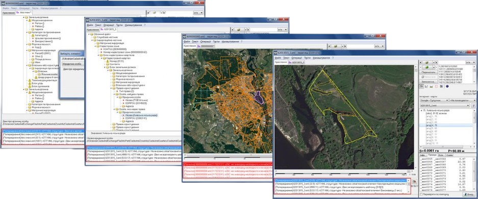
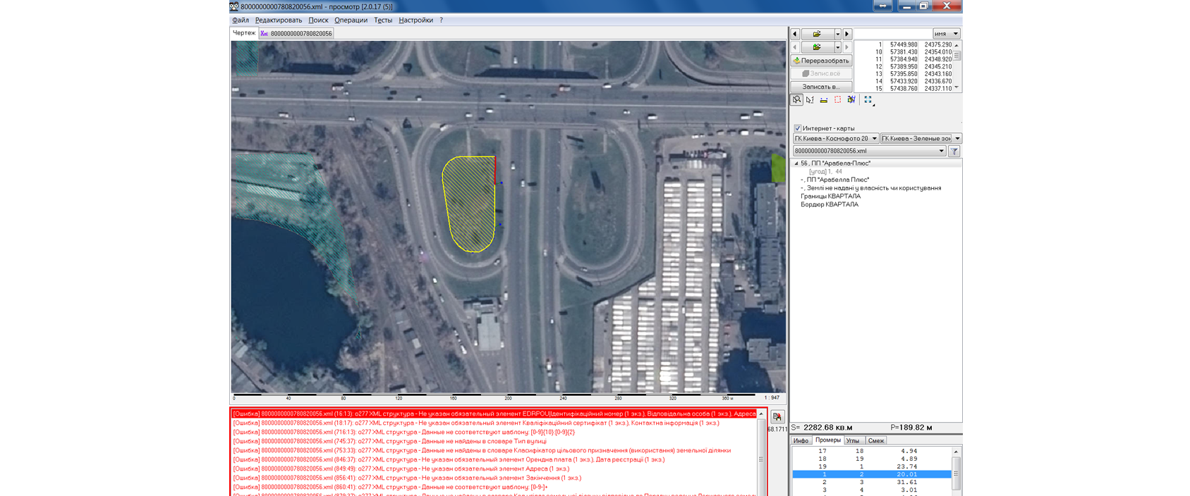
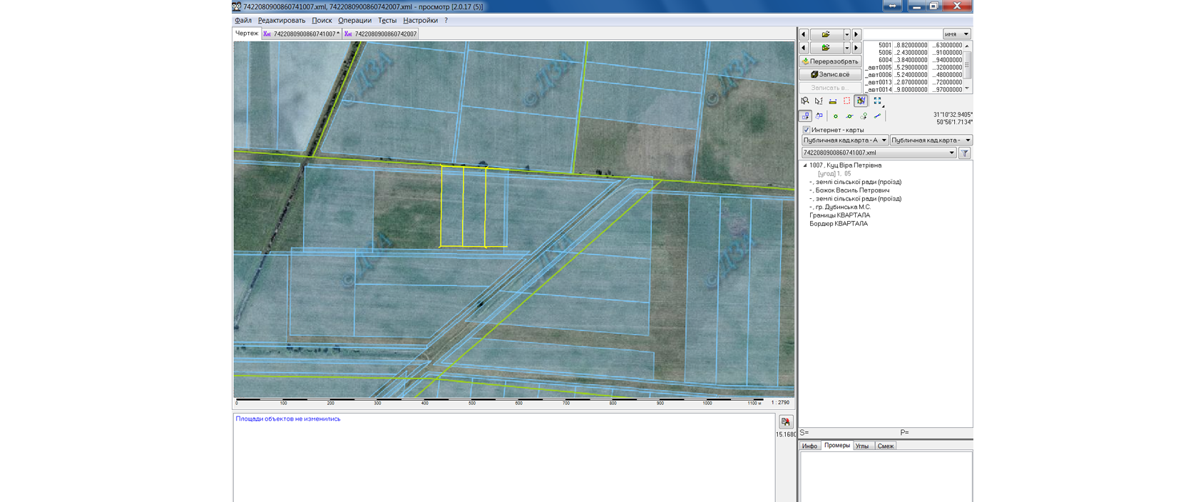
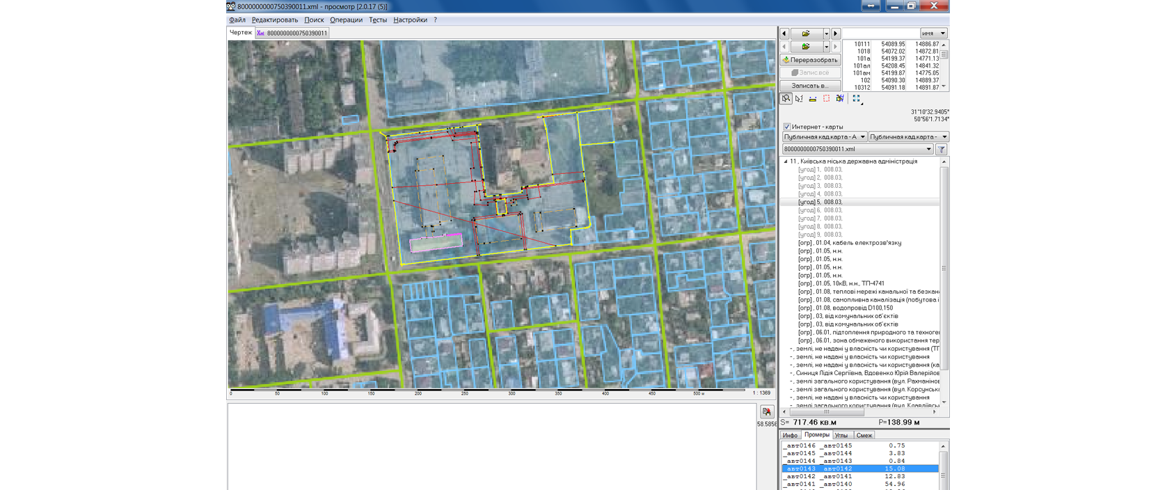
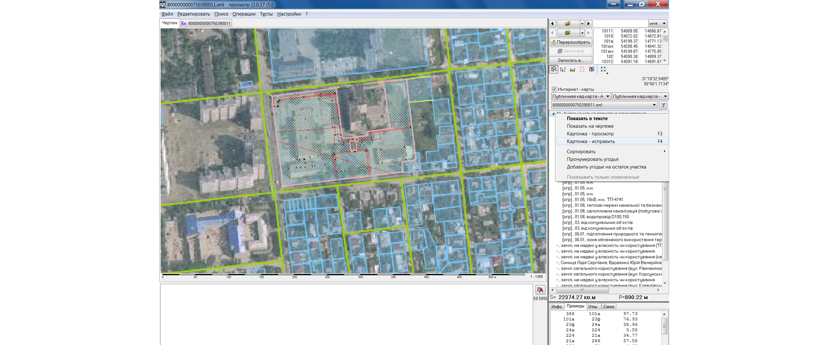
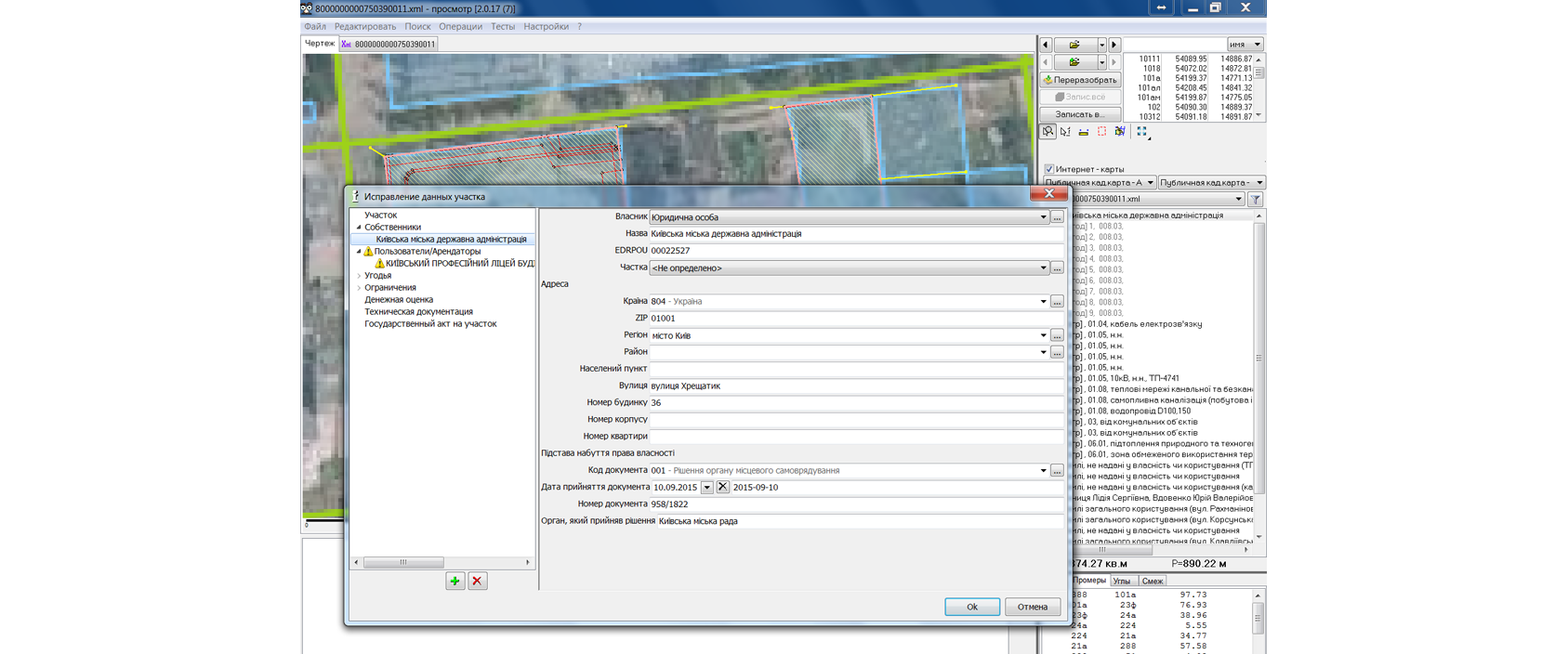
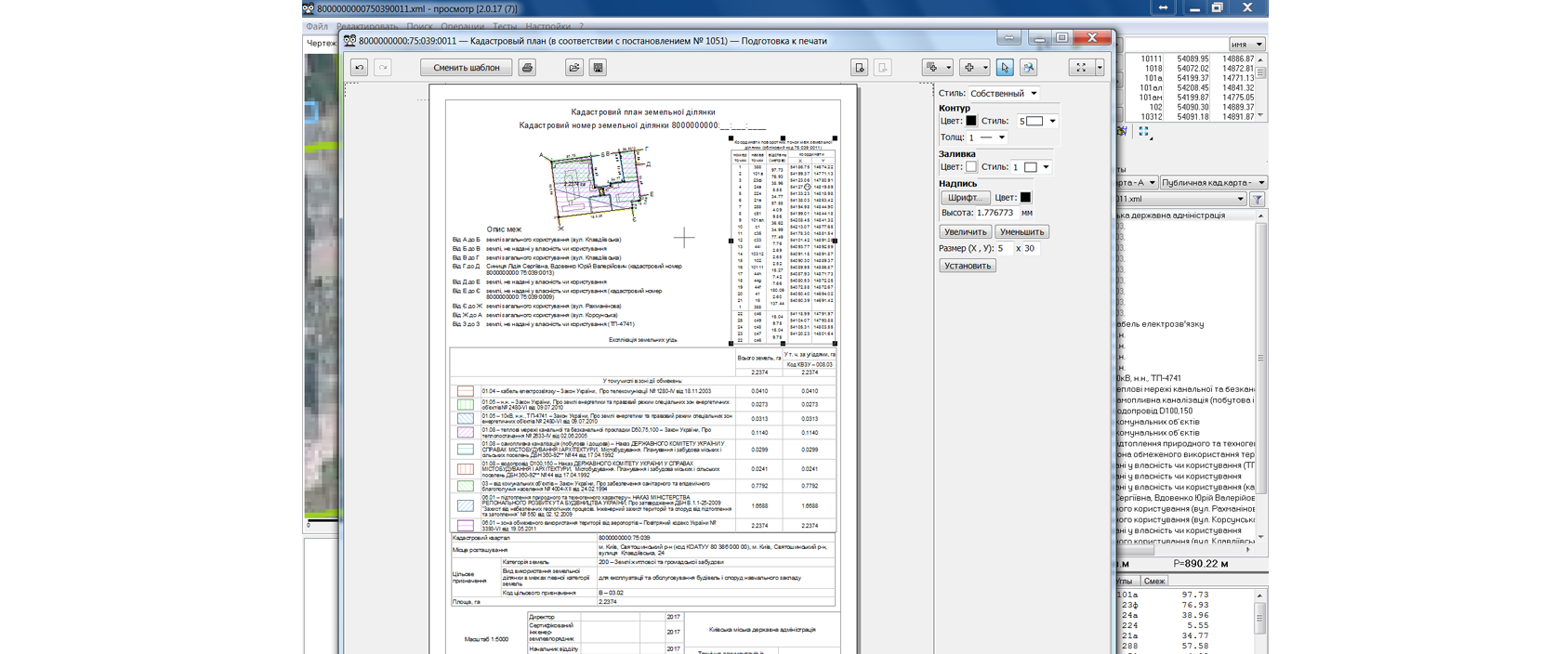
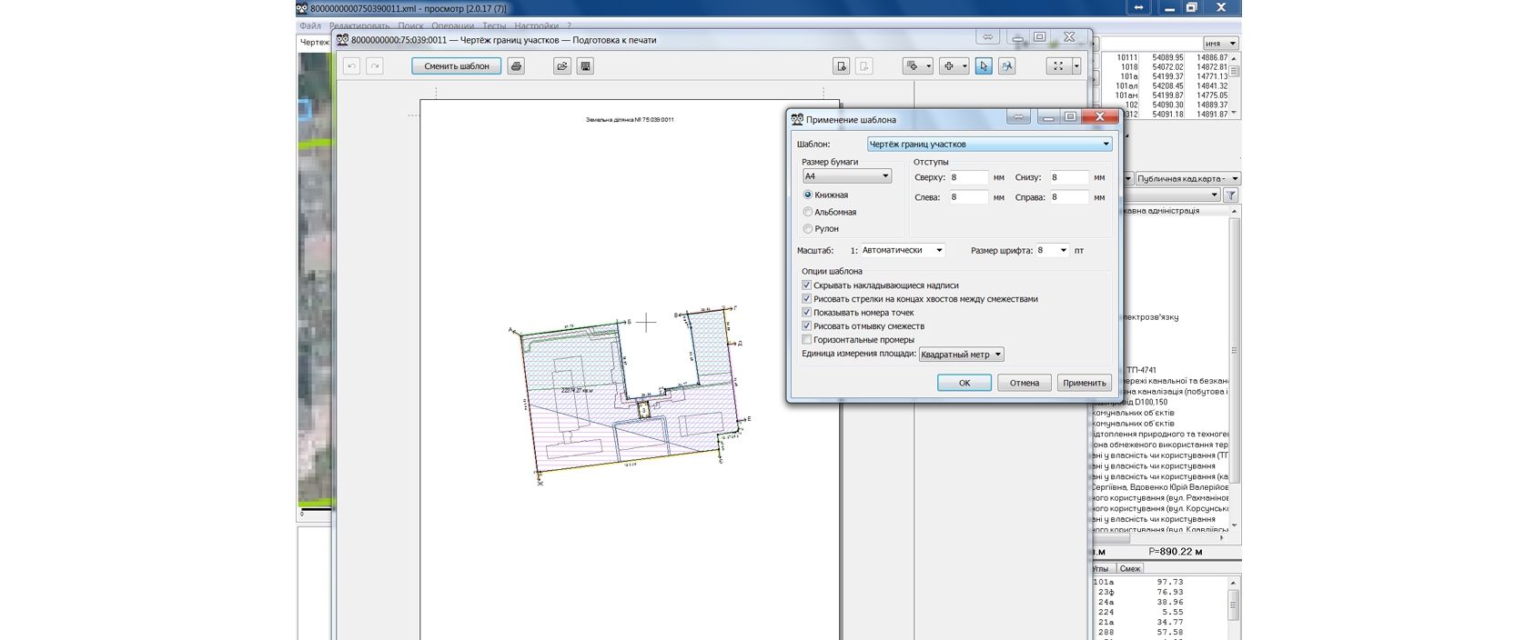
GeoSee will help you open the exchange files, view their content on the map, check files correctness, correct their, make quickly and efficiently printable plans and schemes
Program can also: convert coordinates, fix intersections, find a parcel by cadastral code, divide a parcel into several parcels, open xml with a monetary value and much more...